 |
large map
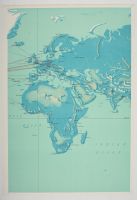
vintage Pan American Airways System world route map, originally published in 1956 and later updated. The map highlights Pan Am's extensive network of flight routes across Europe, Africa, the Middle East, and beyond during the dawn of the commercial jet age.
Map Details
Airline: Pan American World Airways (Pan Am).
Publication Date: The original map design is from 1956, with some editions updated around 1959 and into the mid-1960s.
Cartography & Art: The cartography was done by John Philip, with artwork and design by Paul John Brown.
Content: Red lines indicate the Pan Am flight routes, connecting various cities across continents. The map uses a distinct pictorial style with shaded relief to depict topography.
Purpose: These large maps were often used as promotional materials in airports or travel agencies. |
|
|
